 |
 |
|
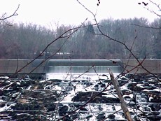
| Main dam at Lake Nockamixon as viewed from Ridge Road in Bedminster, PA. | With the main dam to the right of this picture, a second spillway is at the base of the main dam (seen in this photo from upper left to lower right). |
Lake Nockamixon watershed is approximately 74 square miles (47,360 acres). Flowing into Lake Nockamixon are three main waterways. The Tohickon Creek is the major tributary to the lake and has a drainage area of 44.5 square miles. Other major tributaries include Three Mile Run and Haycock Creek with drainage areas of 4.9 and 6.7 square miles respectively. Lake Nockamixon was created by a damming the Tohickon Creek. A dam can been seen from Ridge Road, and at a 90 degree angle to the dam, a spillway helps to control the excess water from the lake.
|
|
|
| Main dam at Lake Nockamixon as viewed from Ridge Road in Bedminster, PA. | With the main dam to the right of this picture, a second spillway is at the base of the main dam (seen in this photo from upper left to lower right). |
Haycock Creek Watershed
The Haycock Creek watershed is primarily forest and low density residential area (0.043 dwelling unit /acre). State Game Lands are found on a portion of the forested watershed. The stream gradient is 50 ft/mile which is the steepest overall gradient for a watershed in the immediate area above Lake Nockamixon.
 |
 |
|
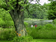
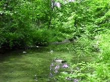
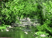
| Haycock Creek enters Lake Nockamixon near Route 563. | The waterway at the left is Haycock Creek; the people fishing in this image are standing next to the entrance to Lake Nockamixon. |
Three Mile Run Watershed
The Three Mile Run watershed is located between two ridges with very stony soils showing low permeability. The density of residential development is 0.124 dwelling/unit. Sanitary sewer extensions have been installed to a portion of the residential area where failing septic systems have been identified.
 |
 |
|
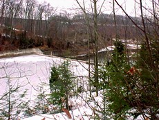
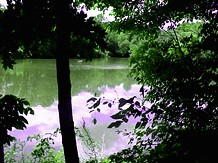
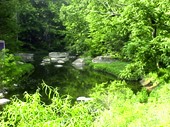
| Three Mile Run enters Lake Nockamixon near Route 113. | The water vegetation is thick along the waterways banks. |
Tohickon Watershed
 |
 |
 |
||
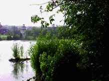
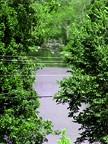
| Tohickon Creek enters Lake Nockamixon near Route 563. | View of entry point of Tohickon Creek. (both views from Rt 563) | View of water behind Weisel Youth Hostel. |
The Tohickon watershed is 44.5 square miles in size. Tohickon Creek has historically been used as a source of power. At one time there were between 12 and 18 dams on the Tohickon furnished power to saw wood, grind grain, card wool, and lift water. Dams were used to make ponds where ice was cut during the winter and stored until needed in the summer months. The remains of two mills and four dams are located in Nockamixon State Park. One dam (in good condition) is located just behind the Weisel Youth Hostel on Richlandtown Road.
In the Tohickon Watershed, land use and geographical conditions are more diverse than the rest of the watershed. Upland forested areas with varying degrees of slope and frequent outcroppings of rock merge with an area of relatively flat slopes composed of silty soils weathered from shale and sandstone. The borough of Quakertown is a center of urban activity in this area where four small creeks combine to form Tohickon Creek.
The Tohickon Creek watershed drainage system is termed dendritic because the tributary network forms the shape of a tree. Stream channel slope below Quakertown continues to be flat (4.9 ft/mile) until just below the Union Avenue bridge. At this point stream gradient increases and bedrock rises much closer to the land surface.,
NOTE: The residential density information is not up to date. The actual density is probably greater at this time.
|
|
|
|
|
|
|